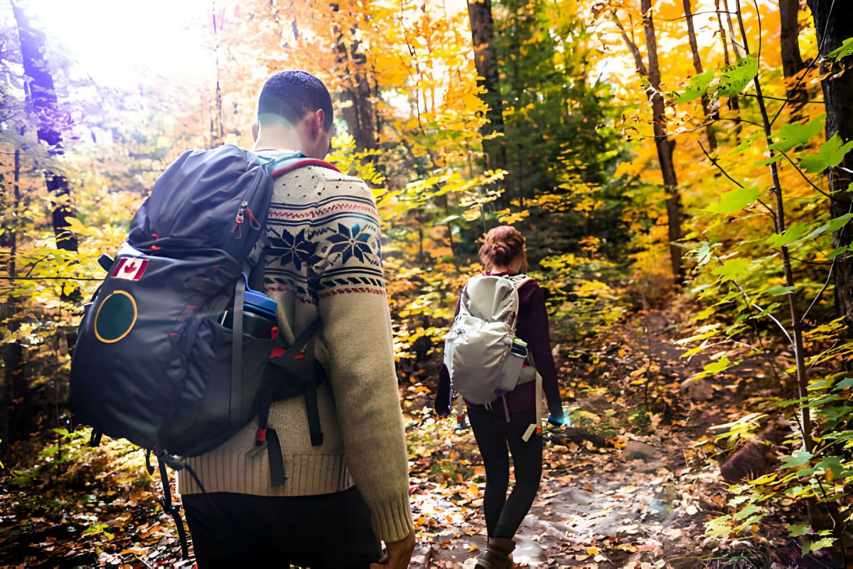
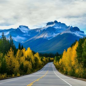
Just a few hours north of Toronto, Algonquin Provincial Park stands as Ontario’s most popular park, boasting beautiful lakes, rivers, and unspoiled wilderness brimming with wildlife. Offering a range of hiking trails, from those covering less than a kilometer to multi-day treks, the park provides access to diverse and wild terrains.
These trails cater to various preferences, offering easy, flat walks along boardwalks and more challenging routes that ascend over ridges to reveal outstanding lookouts. They meander through marshes, and bogs, around beaver ponds and lakes, past stands of old pines, along rock outcrops, and even traverse remnants of historic logging camps.
During spring, it is common to spot moose and other animals along the roadside or trails. While summer is the busy season, the abundance of hikes ensures trails are not overly congested. In fall, Algonquin transforms into a spectacular display of vibrant red, orange, and yellow leaves. Exploring trails along high ridges that overlook the forest and lakes offers a superb way to immerse yourself in the season.
Although most of the trails mentioned are situated along the Highway 60 corridor that runs through the park, a couple can be found on the east side near Achray. Campers will discover hiking trails departing directly from some of the campgrounds in Algonquin..
Choose your preferred trail from our list of the best hikes trails in Algonquin Park.
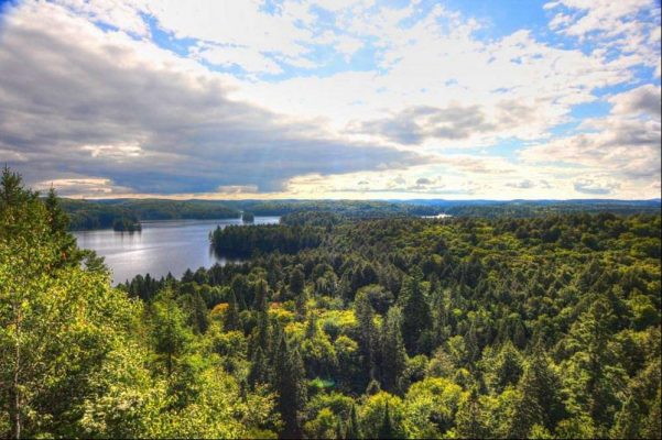
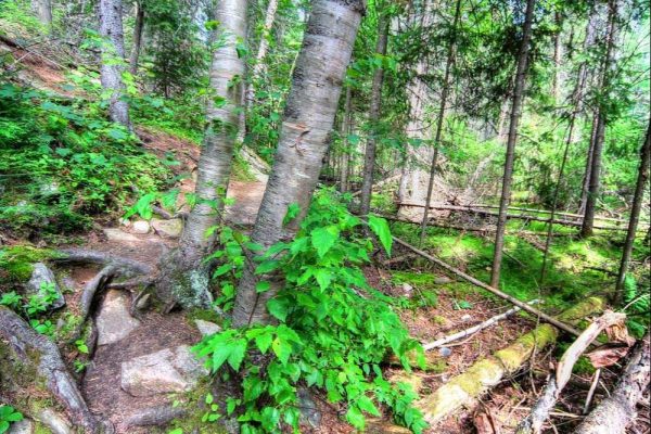
1. Centennial Ridges
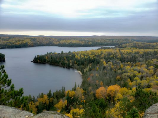
The Centennial Ridges trail offers a breathtaking hike along a sequence of rock ridges, each adorned with lookout points showcasing expansive views of lakes and forests. Widely considered one of the premier autumn hikes in Ontario, the path unfolds amidst deciduous trees displaying vibrant hues of yellow, orange, and red, harmonizing with the evergreen backdrop of pines.
Covering a distance of 10.4 kilometers, this trail is classified as difficult by the park, though technically it falls under a moderate difficulty level. Featuring numerous ascents and descents along the ridges, it stands out as one of the lengthier hikes within the park. While the suggested completion time is six hours, most hikers find themselves concluding the journey in 4.5 to five hours.
To access Centennial Ridges, take the turn at kilometer 37.6 on Highway 60, approximately two kilometers from the highway. During fall weekends, the trail tends to attract a significant number of visitors, possibly requiring parking at a considerable distance from the trailhead.
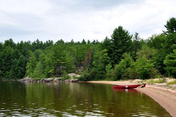
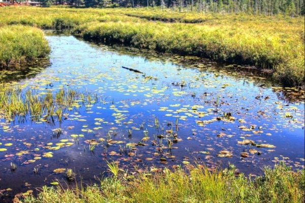
2. Beaver Pond Trail
Winding past two beaver ponds, this trail stands out as a beloved route for numerous Algonquin enthusiasts who return for its scenic charm. Recognized as a prime location for wildlife observation, particularly beavers, it offers opportunities to witness these industrious creatures dragging trees across the ponds or traversing shorelines on game trails. While sightings are more prevalent in spring and fall, beavers remain active throughout the year, leaving their mark with visible dams and lodges in the ponds.
Depending on the season and a bit of luck, visitors may also encounter moose, turtles, and various small animals along the trail.
The trail showcases the quintessential landscape of the Algonquin and Ontario wilderness. Meandering through forests, passing by lakes shaped by beaver activity (some crossed via boardwalk), and ascending rock ridges with scenic viewpoints, it encapsulates the region’s natural beauty.
Despite its modest length of two kilometers, the trail presents uneven terrain with roots and some elevation changes. Plan for approximately one to 1.5 hours to complete the hike, potentially longer if wildlife sightings prompt a leisurely pace.
3. Barron Canyon, Achray
Barron Canyon, while equally spectacular, tends to be less frequented among Algonquin’s attractions due to its remote location within the park. The canyon features towering walls that ascend 100 meters along the Barron River, known for its popularity among canoeing enthusiasts.
Offering stunning views over the water and forest, the 1.5-kilometer Barron Canyon Trail (loop) runs along the north rim.
Unlike sites along Highway 60, Barron Canyon is situated on the east side of the park near Achray, approximately an hour from Pembroke, accessible via Barron Canyon Road.
4. Jack Pine Trail, Achray
Renowned Canadian Group of Seven artist Tom Thomson spent multiple summers in Algonquin Park, drawing inspiration from its landscape. One of his most celebrated pieces, The Jack Pine, was crafted based on the scenery around Achray on Grand Lake.
The Jack Pine Trail, spanning 1.6 kilometers, starts from the Achray Campground and guides visitors to a viewpoint overlooking Grand Lake, where the original jack pine, long deceased, once stood. While the trail’s scenic appeal may not surpass others, its historical significance adds value, especially if you find yourself in this part of the park.
Situated just over 1.5 hours from Pembroke, Achray Campground is located on the east side of Algonquin Park.
5. Track and Tower
The Track and Tower Trail covers a distance of 7.5 kilometers, offering a diverse range of scenery. While the highlight is the breathtaking view from the top overlooking Cache Lake, the trail meanders through the forest, past imposing rock cliffs, along the lakeshore, and traverses an old railway bed. Throughout the hike, there are intriguing sights, including the remnants of old railway bridges.
Although the park rates this hike as difficult, it is mainly due to its significant elevation gain, as the trail itself is not technically challenging. The steepest section features a large set of stairs to facilitate the climb, making it more manageable than ascending over rocks and roots.
The trailhead parking is located at kilometer 25 on Highway 60, and the total duration for this hike is approximately three to four hours.
For an alternative experience, you can combine hiking and biking, incorporating a ride along the Old Railway Bike Trail and a brief hike to the lookout point on the Track and Tower Trail. Starting from the Lake of Two Rivers Campground, also home to the Two Rivers Store offering bike rentals, you can bike around 8.5 kilometers along the well-marked rail trail until it concludes and merges with the Track and Tower hiking trail.
At the designated point, where washrooms and bike stands are available, you can secure your bike. Proceed to hike 1.35 kilometers uphill, including a long set of stairs, to reach the lookout point and then return along the same route. The round-trip duration for this combined hike-and-bike excursion is about three hours.
6. Mizzy Lake Trail
For those seeking a full-day hiking experience, the Mizzy Lake Trail is an ideal choice. Spanning 10.8 kilometers, this trail winds through the characteristic Canadian Shield terrain, taking you past ponds, marshes, and lakes. It is advisable to start early in the morning, as this hike may take longer than anticipated, providing the optimal opportunity to encounter wildlife.
The trailhead for Mizzy Lake is situated off Highway 60, to the east of the Hardwood Lookout trail. It’s worth noting that during spring or following heavy rainfall, the trail may become quite wet and muddy.
7. Hardwood Lookout
This brief hike spans just under one kilometer for the round trip, presenting a gradual ascent to the picturesque lookout point. The panoramic view over the trees and Smoke Lake is delightful, and there’s a bench at the summit for a comfortable rest.
Typically traversed in a counterclockwise direction, the trail can also be hiked clockwise for a less strenuous experience, with the lookout located only a short walk from the trailhead.
The trailhead and parking are situated at kilometer 13.8 on Highway 60, close to the Tea Lake Campground. The hike can be completed in approximately 30 minutes to one hour.
8. Big Pines
Situated at kilometer 40.3 on Highway 60, the Big Pines hiking trail extends for 2.9 kilometers through the forest, passing by the remnants of an 1880s logging camp. The fenced-off ruins may appear nearly non-existent to the untrained eye.
This hike is primarily focused on encountering sizable white pines and gaining insights into the area’s logging history. The colossal trees, dispersed along the trail, were spared during the logging activities.
Most of these impressive pines are concentrated near the trail’s beginning, which is typically hiked in a counterclockwise direction. The path proceeds past the former logging camp location and forms a loop around a wetland area.
A trail guide, available at the trailhead, corresponds to informative signposts along the route, offering details about the area’s history and insights into the trees.
While this trail is relatively easy, featuring uneven ground and rolling terrain, the park recommends a hiking time of two hours. However, it can be comfortably completed in one to 1.5 hours.
For those short on time but eager to witness the majestic white pines, a walk to marker three or four is recommended. The largest tree on the trail is at marker three, and just beyond lies a captivating display of towering pines growing over substantial rocks, with exposed, intertwining roots cascading down the boulders.
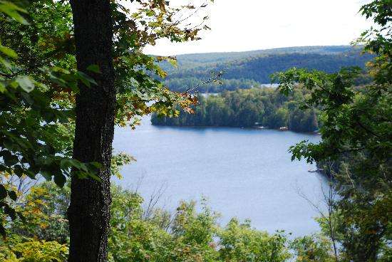
9. The Lookout

Situated at kilometer 39.7 on Highway 60, the Lookout Trail spans two kilometers, leading to a picturesque lookout point that is particularly enchanting during the peak of fall colors.
This moderately steep hike ascends along a broad trail to the summit, revealing a series of viewpoints along a pine-covered ridge. The panoramic vista stretches across a predominantly deciduous forest, undulating hills, and a distant small lake. A couple of benches shaded by foliage at the summit offer an ideal spot for relaxation.
Although the park categorizes this hike as difficult, it is not technically challenging but rather provides a cardiovascular workout due to its steep incline. The total time required for this trial is approximately one hour.
At marker #2 along the trail, denoting a glacial erratic, an arrow points to the right. Opting to go left leads to a slightly shorter trail to the lookout, albeit steeper. The abbreviated trail doesn’t significantly reduce the time spent, and the preferable choice is to complete the full route.
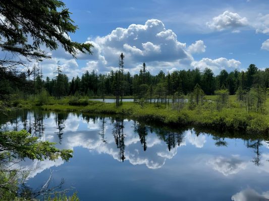
10. Spruce Bog Boardwalk
Located at kilometer 42.5 on Highway 60, near the Big Pines and Lookout trails, is the Spruce Bog Boardwalk. Spanning 1.5 kilometers, this trail offers an easy stroll suitable for the entire family. Most of the trail either traverses a boardwalk over the bog or follows a flat and well-compacted path through a spruce forest.
Serving as an excellent introduction to this wetland environment, the Spruce Bog trail provides opportunities to observe birds, turtles, water lilies, and other wildlife. As a considerable portion of the trail is exposed to full sun without shade, it is advisable to embark on the hike in the morning or on cooler days. The estimated completion time for this trail is approximately 30 minutes, although the park suggests allocating one hour.
11. Whiskey Rapids
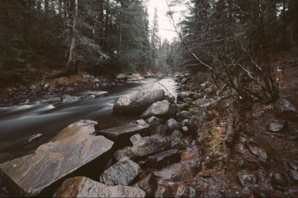
Located at the west end of Algonquin Park, the Whiskey Rapids trail is a relatively easy 2.1-kilometer loop with a couple of steep sections near the start and end. Following the Oxtongue River to Whiskey Rapids, the highlight of the walk, this river hike’s water level fluctuates with the seasons and can be flooded in the spring, so it is essential to check with the park office.
Typically taking about 1 to 1.5 hours, this hike is usually less crowded than those in the more central areas of Algonquin, providing a good opportunity to spot wildlife.
FAQs
Q: Are there guided hiking tours available in Algonquin?
A: While the park doesn’t provide official guided tours, several external companies offer guided hiking experiences.
Q: What wildlife can be encountered during hikes in Algonquin?
A: Hikers may encounter various wildlife, including moose, black bears, deer, and a wide range of bird species. Respect their space and observe from a safe distance.
Q: Is camping allowed on all hiking trails?
A: Camping is permitted only in designated areas. Obtain the necessary permits and follow camping regulations to ensure a responsible outdoor experience.
Q: Are the trails suitable for beginners?
A: Algonquin offers trails of varying difficulty levels. Beginners can choose shorter, easier trails, while experienced hikers can tackle more challenging routes.
Q: What is the best time of year to visit Algonquin for hiking?
A: The best time depends on personal preferences. Spring and fall offer pleasant weather and scenic views, while winter provides a unique snow-covered landscape.
Related posts:
 14 Top Tourist Attractions & Things to Do in Québec
 13 Top Tourist Attractions & Things to Do in Ottawa
 15 Top Tourist Attractions & Things to Do in Montreal
 12 Best National Parks in Canada
 11 Top Tourist Attractions in Alberta, Canada
 10 Best Things to Do in Saskatchewan
 10 Best Things to Do in Quebec City, Canada
 12 Best Beaches in Ontario You Need to Vist
 10 Best Places to Visit in Charlottetown Before You Die
 12 Best Places to Visit in Edmonton Before You Die
 10 Best Things to Do in Jasper, Alberta
 10 Best Places to Visit in Prince Edward Island