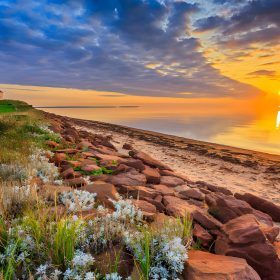
Killarney Provincial Park and the encompassing mountains and woodlands just beyond its borders boast some of the best hiking trails in Ontario. The white quartzite mountains, serene inland lakes, and the breathtaking scenery of Lake Huron’s Georgian Bay form a diverse landscape that caters to various hiking experiences.
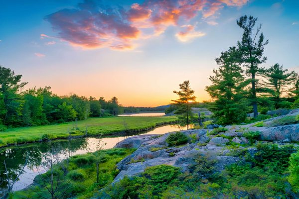
This park holds a special place in my heart, primarily due to its exceptional hiking opportunities. The allure of this place never diminishes for me, with each season offering a unique charm. Fall dazzles with spectacular photography opportunities but attracts substantial crowds. Spring is ideal for wildlife sightings, though bug spray is essential. Summer brings sheer delight, allowing for refreshing swims in the lakes and the full enjoyment of the park’s offerings.
While hiking the trails, the sight of sailboats racing across the sparkling blue waters of the Bay and canoes peacefully gliding on still lakes is a common spectacle. The park teems with wildlife, featuring black bears, deer, moose, and foxes.
The park maintains numerous trails within its boundaries, marked by blue and red markers on trees or painted on rocks. Stone piles over open rock sections indicate the direction. Trails outside the park, managed by the municipality or local hotels, use a variety of markers, typically colored paint marks on trees and rocks. Some of these external routes may be more challenging to follow than those within the park.
Hiking distances provided below are for round trips unless otherwise specified.
Killarney Provincial Park stands out as one of the most popular parks in Ontario, not only for hiking but also for camping. If camping is on your agenda, make sure to book well in advance.
For guidance on choosing the best trail for you, refer to my list of the top hikes in Killarney.
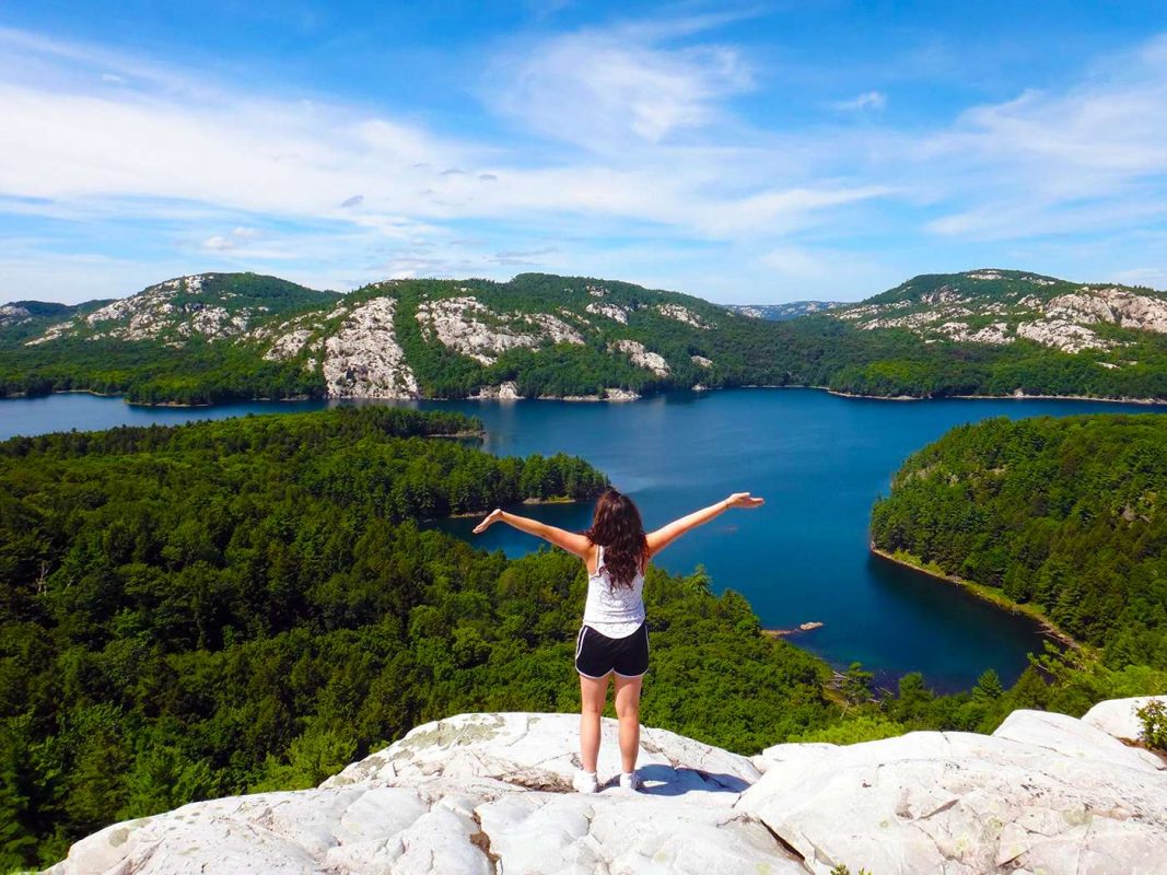
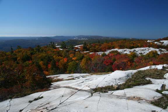
1. The Crack
The Crack stands out as Killarney’s premier hike, showcasing the region’s white rock mountains and providing a breathtaking view of the inland lakes. During the fall foliage, when the leaves undergo a vibrant transformation, this hike ranks among the best in all of Ontario.
However, the reward requires effort. The Crack earns its name from a fissure in the mountains, where large rocks have descended onto the upper part of the trail, creating a challenging scramble over boulders that demands the use of both hands and feet.
Fortunately, the crack constitutes only a small section near the summit, and most hikers can navigate it easily if they possess the fitness to handle the ascent up to that point.
In contrast to many hiking trails around Killarney characterized by short ups and downs, this trail resembles a mountain hike, involving a gradual ascent to the top and a return trip along the same route. It is common to observe individuals turning back midway or waiting near the top, just before the crack, as they realize the trail is more demanding than expected.
The entire trail spans six kilometers and is situated within Killarney Provincial Park. The route is well-marked, and well-maintained, and typically takes between three and four hours on average.
The trailhead is positioned along the main highway, seven kilometers east of the park office.
2. Chikanishing Creek
Chikanishing Creek offers a delightful hike with stunning elevated views encompassing the creek, Georgian Bay, and its surrounding islands and rocks. It also provides direct access to the rugged shoreline of Georgian Bay.
This hike is my preferred choice whenever I visit Killarney. It’s not just about the final view; the entire hike is enjoyable, boasting a favorable effort-to-reward ratio. Often, I opt for the high lookout over the Bay rather than heading directly to the water’s edge.
Covering a distance of three kilometers, the trail follows rock ridges along Chikanishing Creek, leading to Georgian Bay. The section up to the highest lookout, just before the descent to the shoreline, is relatively easy to moderate. Beyond the lookout, the trail descends to the water, featuring some challenging rock sections that may require the use of both arms and legs to navigate over ridges.
On a warm summer day, I recommend going all the way to the end. Along the shoreline, the smooth rocks create a delightful spot to relax or take a swim. Long veins of quartzite run through the red rock, extending into the crystal-clear water. The trail then ascends back over the ridge and returns through a forested path.
The total time for this hike is approximately one to 1.5 hours. For those short on time or not inclined to navigate the rocky descent to the Bay, you can reach the lookout, marked by a plaque, in about 20 minutes and return the same way for a round-trip of 40 minutes. This segment represents the most scenic portion of the route.
3. George Island
George Island, situated just across the channel from downtown Killarney and most easily reached by a brief boat shuttle from the Sportsman’s Inn, imparts a sense of remoteness due to its island location. Since this hike is not actively promoted by the park, it tends to be less crowded. Combine this with the captivating scenery of beaver ponds and the rugged, exposed shoreline of Georgian Bay, and the journey beyond the park boundaries becomes a worthwhile adventure.
Commencing from the dock, the George Island hike winds through a forest of pines and deciduous trees, passing by beaver ponds before emerging onto Georgian Bay. The water’s edge is adorned with smooth, wave-polished stones in hues of red, grey, green, yellow, and orange, while further along, pink granite outcrops define the shoreline. Some sections may be marshy and dependent on water levels, but alternative routes skirting high water are generally easy to find.
Along the shoreline, remnants of an old tar vat, once utilized by fishermen to reinforce their nets, can be observed. Eventually, the trail veers back inland, leading back to the dock.
The full hike spans approximately 7.5 kilometers and requires three to four hours to complete. For a quicker, easier option, follow a counterclockwise direction until reaching Georgian Bay, enjoy the views along this stretch, and return on the same route. This transforms the hike into about a 4- to 4.5-kilometer round-trip, depending on how much of the shore is explored, and can be finished in a couple of hours.
The George Island trail presents a good opportunity for wildlife sightings. Sportsman’s Inn staff will typically inform you about the presence of bears in the area, enhancing the potential for bear encounters along the trail.
4. Silver Peak
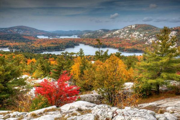
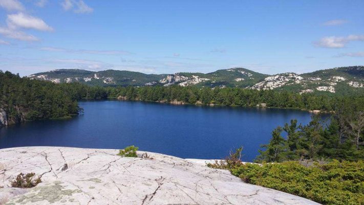
Silver Peak, situated in the La Cloche Mountains, holds the distinction of being the highest point in Killarney Provincial Park and is a recurring subject in paintings and photographs depicting the park. The summit of this radiant white quartzite peak offers unobstructed panoramic views, extending in all directions to encompass the surrounding lakes, undulating mountains, and the expanse of Georgian Bay. Undoubtedly, this vantage point provides the most breathtaking scenery in the park, albeit requiring some effort to reach.
For those opting for a day hike, the trailhead is exclusively accessible by canoe or kayak, involving a three-kilometer paddle each way.
Commencing from the trailhead, the hike initially follows a level path through the forest for approximately three kilometers before taking a sharp turn and ascending 2.5 kilometers to reach the peak. The final stretch involves a steady climb with steep sections, ultimately emerging from the tree cover onto the gleaming, white, bald mountain peak. At the summit, two lookout areas are situated on adjacent peaks.
This constitutes a 12-kilometer round-trip hike, complemented by a six-kilometer round-trip paddle. An alternative option is incorporating this hike as a side trip from the 78-kilometer La Cloche Silhouette hiking trail. Starting from the George Lake Campground, the journey covers 25 kilometers one way on the La Cloche Silhouette trail to the Silver Peak trail.
Access to this hike is at the terminus of Bell Lake Road, where a park office and on-site canoe rentals are available through Killarney Kanoes. The paddle is relatively straightforward, and the trailhead is easily identifiable at the far end of a bay, preventing inadvertent paddling past the trailhead.
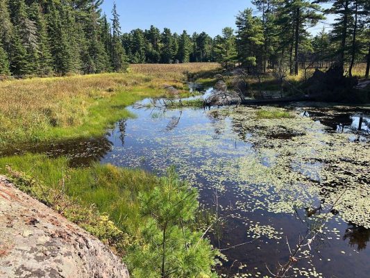
5. Cranberry Bog
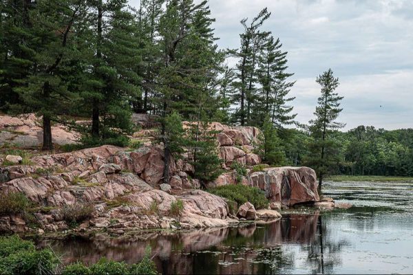
The Cranberry Bog hike offers a charming trail that winds through a diverse forest, crosses a beaver dam, and meanders past wetlands and lakes. On Cranberry Bog, beaver houses dot the landscape, and with a bit of luck, you may spot beavers and other wildlife. The trail follows the bog along a shore adorned with smooth, pink rock and dotted with pine trees.
In the final quarter of the hike, the trail merges with the La Cloche Silhouette trail, guiding you past A. Y. Jackson Lake and concluding at the George Lake Campground, not far from the starting point. A brief side trail, where the two paths converge, allows for additional lake scenery. At the trail junction, the Cranberry Bog trail continues to the left, but by turning right and walking approximately 300 meters on the La Cloche Silhouette trail, you’ll reach Sheguiandah Lake.
A backcountry campsite on this lake, marked with a yellow arrow, provides excellent views of the colorful cliff walls on the opposite shoreline if unoccupied. After exploring the campsite, retrace your steps to reconnect with the Cranberry Bog trail.
For another picturesque extension, upon reaching A.Y. Jackson Lake, you’ll notice a full view down the lake to the white cliffs of the La Cloche Mountains. A yellow marker along the hiking trail signals a trail branching off to the right, leading to campsites about 700 or 800 meters along the lakeshore. Ascend halfway up this campground trail to a high lookout point with a fantastic view of the lakes and mountains. Once again, return along this path to rejoin the main trail. The total time for this hike is approximately 2 to 2.5 hours.
6. La Cloche Silhouette Trail
This trail stands as one of Ontario’s enduring multi-day hikes. Named after the painting “La Cloche Silhouette” by Franklin Carmichael, a member of the Group of Seven inspired by Killarney, the 78-kilometer loop traverses some of the park’s most picturesque lakes, highest lookouts, and diverse forest landscapes.
Backcountry campsites, requiring reservations, are strategically positioned along the trail, necessitating hikers to carry all their gear. Typically, completing the entire journey takes about a week to 10 days.
The main trail, identifiable by blue markers, features side trails marked in red leading to lookout points on prominent hikes such as The Crack and Silver Peak. This challenging hike through remote wilderness demands meticulous planning, encompassing reservations, food provisions, and necessary gear. Local outfitters in Killarney, including Killarney Outfitters, stand ready to assist hikers with their preparations.
Accommodation: Where to Stay near in Killarney Provincial Park: Best Areas & Hotels
FAQs
Q: Is camping allowed in Killarney Provincial Park?
A: Yes, camping is allowed in designated areas within the park. Make sure to obtain the necessary permits.
Q: Are pets allowed on the hiking trails?
A: Pets are allowed in some areas of the park but must be kept on a leash. Check specific trail regulations for details.
Q: Can beginners attempt The Crack Trail?
A: The Crack Trail is recommended for experienced hikers due to its challenging terrain.
Q: Are there guided hiking tours available?
A: Yes, the park offers guided hiking tours. Check with the park authorities for schedules and availability.
Q: What wildlife might I encounter during my hike?
A: Keep an eye out for various wildlife, including moose, deer, foxes, and a variety of bird species.
Related posts:
 12 Top Tourist Attractions & Things To in Canada
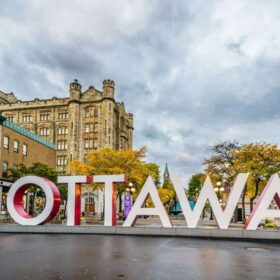 13 Top Tourist Attractions & Things to Do in Ottawa
 15 Top Tourist Attractions & Things to Do in Montreal
 15 Top Tourist Attractions & Things to Do in Vancouver, BC
 11 Top Tourist Attractions in Alberta, Canada
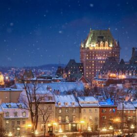 10 Best Things to Do in Quebec City, Canada
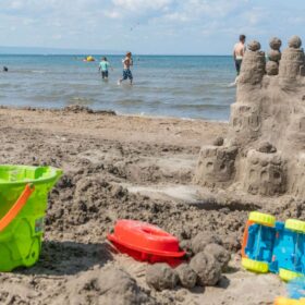 12 Best Beaches in Ontario You Need to Vist
 12 Best Places to Visit in Edmonton Before You Die
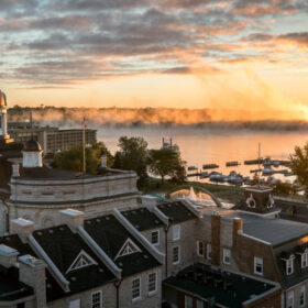 11 Best Places to Visit in Kingston, Ontario
 10 Best Places to Visit in Prince Edward Island
 10 Best Beaches in Toronto You Need to Visit this Summer!
 9 Best Trails and Hikes in Lake Louise