Covering an expansive area almost six times the size of the United Kingdom, the Northwest Territories encompass a vast region in Canada, situated north of the 60th parallel and extending toward the North Pole. This land is characterized by towering mountains, formidable rivers, and treeless tundra, creating a challenging yet unforgettable environment that leaves a lasting impression long after your visit. The territory spans from the high Mackenzie Mountains in the west to the tundra regions in the east, bordering the Nunavut Territory established in 1999.
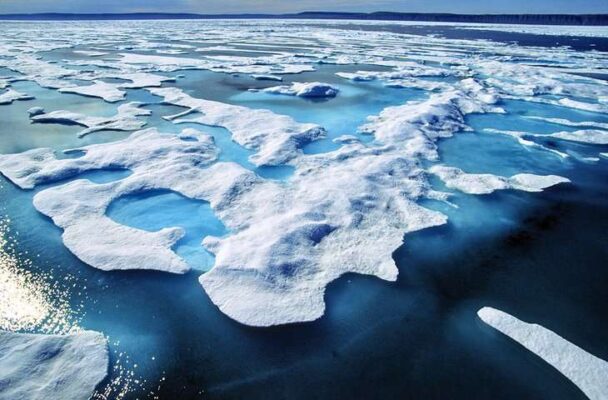
In the brief summer, lasting only a few weeks, the region experiences a burst of frenetic growth as plants, animals, and humans seize the opportunity presented by the fleeting warm days. The continuous daylight, with the sun barely setting, facilitates the endeavor to make the most of this short-lived season, earning the region the nickname “land of the midnight sun.” Conversely, the winter brings extended periods of darkness during the “polar night,” with temperatures dropping to -30 degrees Celsius for days and sometimes weeks across the territories.
To enhance your experience in this captivating part of Canada, consult our guide to the top tourist attractions in the Northwest Territories.
1. Nahanni National Park Reserve
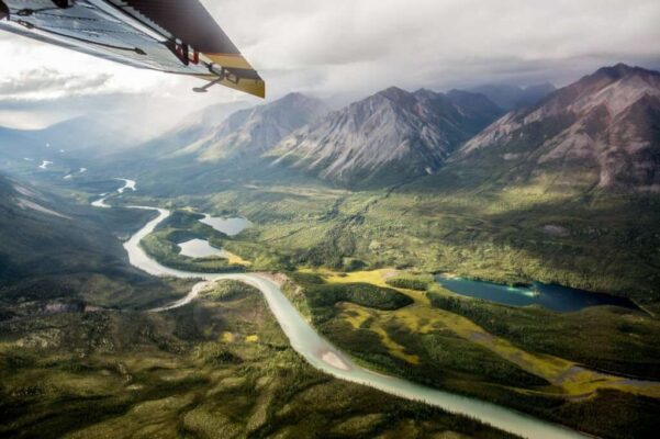
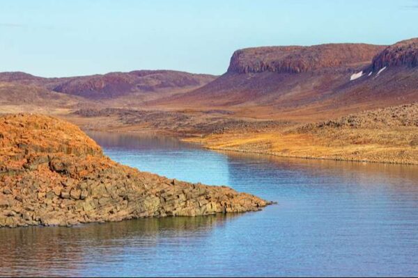
The remote Nahanni National Park Reserve stands out as one of northern Canada’s treasures and ranks among the premier destinations in the Northwest Territories for outdoor enthusiasts. Within this park, the tumultuous Nahanni River meanders through the breathtaking canyon scenery of the Mackenzie Mountains, presenting a challenge for experienced canoeists and rafters. Adding to the allure, the South Nahanni River cascades over the 90-meter precipice of the stunning Virginia Falls, forming one of the most remarkable waterfalls in Canada.
Among the park’s sightseeing attractions is the Rabbitkettle Hot Springs, which nurtures a diverse landscape of rare plants. While the idea of taking a dip in the hot springs may be tempting, the delicate nature of this beautiful natural feature mandates that tourists can only visit as part of a guided tour.
2. Yellowknife
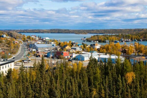
Yellowknife, the vibrant capital of the Northwest Territories, flourished amidst the excitement of a gold rush in the 1930s. As you explore Old Town, you’ll notice a vibrant blend of wooden heritage buildings, arts and cultural institutions such as the Prince of Wales Northern Heritage Centre, and a lively community thriving on the energy of the mining industry. The miners’ tents that once stood here have been replaced, creating a unique travel experience.
One of the popular activities to enjoy while traveling is taking boat tours and experiencing the thrill of house boating on the magnificent Great Slave Lake. While exploring the beautiful Hidden Lake Territorial Park, don’t miss the breathtaking falls that will leave you in awe. Immerse yourself in the local art scene by visiting galleries that showcase the works of talented artists. And make sure to pay a visit to the iconic Bush Pilots Monument, a must-see attraction.
If you happen to visit this destination during the winter season, you will have the incredible opportunity to witness the breathtaking beauty of the Aurora Borealis, which is unparalleled in this area. The Snow King Festival and its magnificent snow castle are a must-see for travelers. Don’t hesitate to embark on an exciting adventure, as the city comes alive in March.
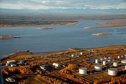
3. Hay River
Located on the southern bank of Great Slave Lake, Hay River stands as the southernmost port within the Mackenzie River System. This port serves as a crucial transfer point for freight, primarily consisting of building materials and fuel destined for settlements along the Mackenzie River and in the Arctic, which is loaded onto barges. Throughout the four- to five-month summer season, the port bustles with activity, hosting barges, fishing boats, and coast guard launches.
With a history deeply rooted in the First Nations community, Hay River gained prominence as the inaugural Hudson’s Bay Company trading post in 1868. The quaint wooden houses of the old town are situated at the mouth of the Hay River, serving as residences for the local fishermen who often return with abundant catches from Great Slave Lake or the Hay and Mackenzie Rivers.
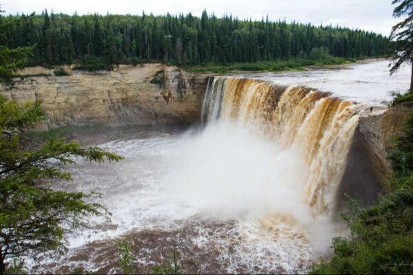
In the more contemporary part of town, Diamond Jenness School stands as an exceptional example of northern architecture. Named after an anthropologist who, around 1910, pioneered the study of northern native culture, the school’s distinctive purple hue makes it a landmark in Hay River. To the southwest of town, Twin Falls Gorge Territorial Park showcases the Hay River Canyon and the Alexandra and Louise Falls, offering trails and a viewing area.
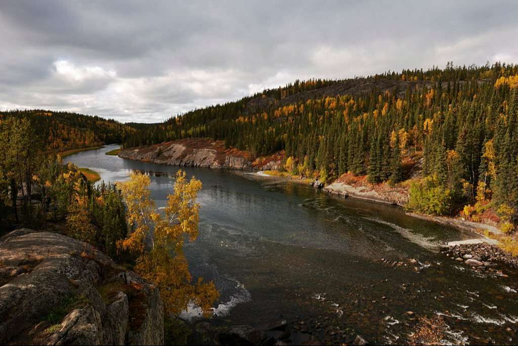
4. Mackenzie River
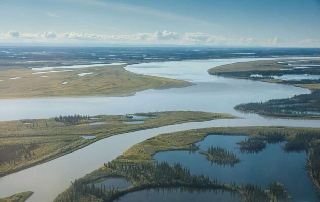
Stretching over 4,250 kilometers, the Mackenzie River stands as the second longest river in North America, covering a fifth of Canada within its catchment area. During the 18th century, the river served as a vital waterway for fur trade canoes and remains navigable in the summer months, allowing steamers to travel upstream as far as Fort Smith.
Constructed shortly after World War II, the Mackenzie Highway is an all-weather road spanning 600 kilometers from Peace River in Alberta to Great Slave Lake and the territorial capital Yellowknife.
Fort Simpson, positioned at the confluence of the Liard and Mackenzie Rivers west of Great Slave Lake, holds the distinction of being the oldest settlement on the Mackenzie River. Established in 1804 by the North West Company, the fort served as a strategic junction for the trans-shipment of skins and furs. In the 19th century, sporadic trade occurred with trappers and fishermen, but the first half of the 20th century witnessed the burgeoning paper industry’s interest in the Mackenzie Valley forests.
The subsequent discovery of oil in Norman Wells in the 1920s, pitchblende at Port Radium, and gold at Yellowknife in the 1930s led to a thriving mining industry after World War II. Fort Simpson also serves as a departure point for flights to Nahanni National Park Reserve.
The delta landscape of this region is characterized by low bushes, shrubs, juniper, lichens, and mosses, with vibrant displays of flowers and mosses during the brief but intense summer (from June to late July, a period known for the midnight sun). Beyond the flora, the environment boasts a diverse range of wildlife both on water and land.
5. Banks Island
Banks Island boasts lush tundra vegetation and hosts a significant wildlife population, notably more than 65,000 musk-oxen (Ovibus moschatus), constituting the largest population worldwide. The southwestern section of Banks Island, encompassing about one-third of its total landmass, serves as a bird sanctuary.
While it had been utilized for hunting for approximately 3,500 years, Banks Island saw its first permanent settlement in 1929 when three Inuit families established themselves in Ikaahuk (Sachs Harbor) on the northwestern tip. The island’s “European” name originates from the Canadian Arctic expedition of 1913-15 led by Vilhjalmur Stefansson, whose ship was named Mary Sachs.
Aulavik National Park, located in the northern part of Banks Island, is home to a significant musk-oxen population and hosts a large number of Canada’s snow geese during the summer. The park preserves an entirely intact tundra flora. This extremely remote destination attracts adventurers seeking opportunities for hiking, backpacking, or paddling along the Thomsen River.
Given the absence of services within Aulavik National Park, visitors are expected to possess outdoor experience and self-sufficiency. Access to the park is typically facilitated by chartering aircraft, often from Inuvik.
6. Wood Buffalo National Park
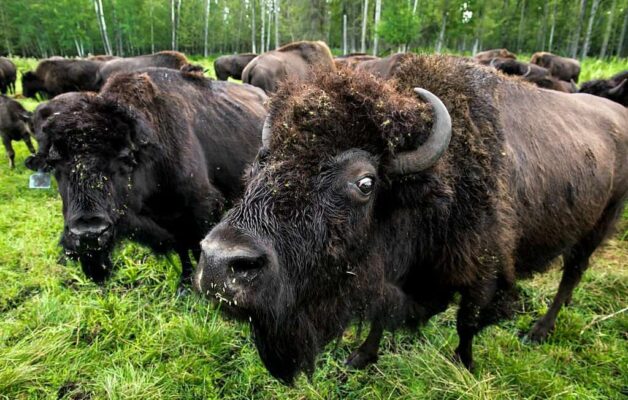
Wood Buffalo National Park holds the title of the largest national park in Canada and the second-largest globally. Designated as a UNESCO World Heritage Site, this expansive protected area spans extensive landscapes in both Alberta and the Northwest Territories.
Initially established to safeguard the herds of wood buffalo inhabiting the region, the park has evolved into a refuge for various significant species, including the highly endangered whooping cranes that find sanctuary in the delta region. Once a fur-trading post, Fort Smith now serves as the starting point for ventures into the park, with bison frequently observed from the highway near the town.
7. Norman Wells
Established in 1920 as an oil town, this small northern settlement, known as Tlegohli, meaning “Where There is Oil,” surprisingly accommodates a population of only 800 residents, yet boasts two remarkable museums. The Norman Wells Historical Society oversees an exhibit dedicated to the town’s history, the construction of the Canol Trail, unique fossils found in the area, and local Sahtu Dene crafts.
A must-see is the Historical Aviation Museum, offering insights into the early pilots and planes pivotal in opening up the entire region. Archaeology enthusiasts may explore Fossil Canyon to discover ancient artifacts from the Sahtu people.
For avid hikers with ample time, embarking on Canada’s longest hike, the 355 km Canol Trail, provides a challenging three-week adventure. Alternatively, day hikers can contact local guides for excursions into the Franklin Mountains. Even non-hikers can enjoy a flightseeing tour for breathtaking views of some of the most spectacular scenery.
8. Victoria Island
Situated just off the northern coast of mainland Canada, Victoria Island ranks as the third largest island in the Canadian Archipelago. It resides well north of the Arctic Circle, where the terrain, shaped by Ice-Age glaciers, unfolds into a somewhat monotonous landscape of moraines, drumlins, and glacial lakes. The island was administratively divided into two following the establishment of the Territory of Nunavut in 1999.
Iqaluktuutiak (Cambridge Bay) on the island’s southeast coast serves as the administrative and supply hub for Canada’s central Arctic region. Sir John Franklin (1786-1847) “discovered” Victoria Island in 1826, with European seafarers, missionaries, and fur traders being among the earliest visitors to this remote location. Until the 1950s, the Copper Inuit primarily used the area as a summer camp, referring to it as “Iqaluktuutiak” in Inuktitut, meaning “good place to fish.”
Modern features of Iqaluktuutiak include its stone-built Catholic church and a contemporary wind-generation plant. The second noteworthy location on Victoria Island is Ulukhaktok (formerly Holman) on the west coast. Situated at the tip of the Diamond Jenness Peninsula, this small community is well-prepared for the growing number of tourists attracted to the North. There’s even a golf course offering views of the Beaufort Sea.
9. Great Slave Lake
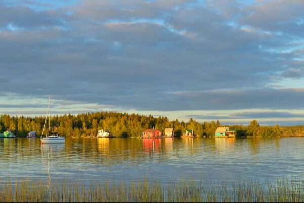
Great Slave Lake, North America’s fifth largest lake, plunges to depths of over 600 meters in certain areas. Although it remains frozen for eight months of the year, it remains a hub of activity. During the summer, freshwater enthusiasts such as houseboaters and sailors revel in its waters. Notably, the lake hosts the Commissioner’s Cup, the world’s longest freshwater sailing race.
For fishing enthusiasts, the lake offers a chance to venture onto the water and test their skills against the legendary giant trout that lurk in its depths, some weighing up to 40 pounds. Whether bringing your boat for a chance encounter or opting for a charter to ensure success, the fishing experience is unmatched.
In winter, the frozen surface becomes a racetrack for dog sledders. Numerous major communities in the Northwest Territories line the lake, including Yellowknife, Fort Providence, and Hay River.
10. Inuvik
The Inuit translation of “Place of Man” is Inuvik, a contemporary settlement located in the Arctic Circle and along the Mackenzie River. Constructed between 1955 and 1961 during the search for oil and gas, Inuvik replaced Aklavik, which was susceptible to flooding.
Presently, Inuvik serves as the trading, administrative, and supply hub for the western Arctic. It features an airfield, multiple schools, and a hospital. Numerous supply planes depart from here, heading to exploration bases in the far north, including the Mackenzie Delta and the Beaufort Sea. Sightseeing flights over the Arctic also originate from Inuvik.
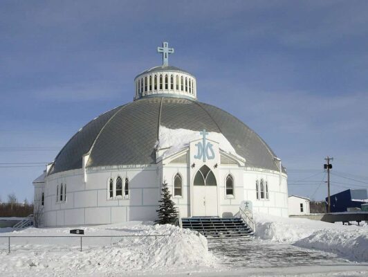
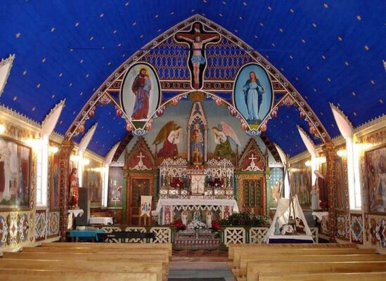
The distinctive igloo-shaped Our Lady of Victory Roman Catholic Church has become an iconic structure in Inuvik, housing an igloo-shaped tabernacle and an impressive “Way of the Cross” by Inuit artist Mona Thrasher. Aklavik, translating to “home of the polar bears,” is located west of Inuvik. Founded by the Hudson’s Bay Company in 1912, it sits in the heart of the Mackenzie Delta, an area prone to flooding and accessible only by a winter ice road.
To the east of Inuvik, Tuktut Nogait National Park was established in 1996, showcasing breathtaking Arctic rock landscapes with impressive canyons and cliffs. Archaeological findings at numerous sites within the conservation area reveal that this now-challenging region was inhabited thousands of years ago. Access to the park is exclusively by air, but the experience is worthwhile if feasible.
11. Fort Good Hope
The national historic site of the Church of Our Lady of Good Hope in Fort Hope was constructed in the mid-1880s. It stands as one of the oldest surviving buildings of its kind, featuring a spectacular interior decoration designed and executed by Father Émile Petitot. The mission church was erected in the Gothic Revival Style.
Adjacent to the left side of the church, there is a historical graveyard with intriguing headstones, some of which date back to the turn of the century.
FAQs
Q: When is the best time to visit the Northwest Territories for Aurora Borealis viewing?
A: The best time to witness the Northern Lights is during the winter months, from late September to early April.
Q: What safety precautions should be taken on the Dempster Highway road trip?
A: Ensure your vehicle is well-maintained, carry essential supplies, and check weather conditions before embarking on the Dempster Highway.
Q: Are there guided tours available for exploring Wood Buffalo National Park?
A: Yes, various guided tours provide insights into the park’s wildlife, ecosystems, and conservation efforts.
Q: What is the significance of the Mackenzie River in the history of Northwest Territories?
A: The Mackenzie River played a vital role in the exploration and development of the region, serving as a key transportation route.
Q: How can tourists contribute to sustainable tourism in Northwest Territories?
A: Travel responsibly, support local conservation projects, and engage in cultural exchanges to ensure a positive impact on the region’s sustainability.
Related posts:
 12 Top Tourist Attractions & Things To in Canada
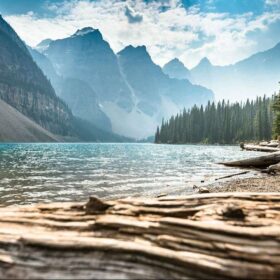
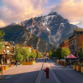
 11 Top Tourist Attractions & Things to Do in Banff National Park
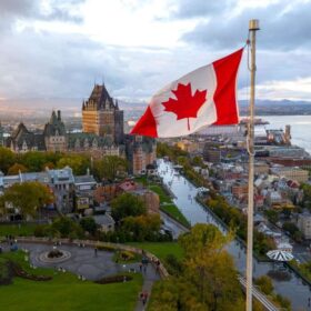
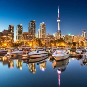 16 Best Cities to Visit in Canada
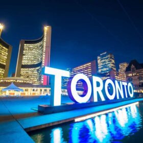 20 Top Tourist Attractions & Things to Do in Toronto
 15 Top Tourist Attractions & Things to Do in Montreal
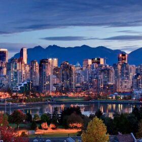
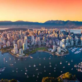 15 Top Tourist Attractions & Things to Do in Vancouver, BC
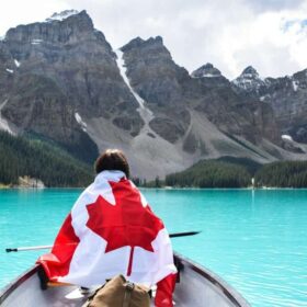
 15 Best Places to Visit in Canada
 11 Best Lakes in Canada
 15 Most Charming Small Towns in Canada
 16 Top Tourist Attractions & Things to Do in British Columbia
 11 Top Tourist Attractions in Alberta, Canada
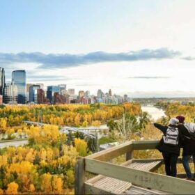 12 Top Tourist Attractions & Places to Visit in Calgary